 An
official website of the United States government.
Here's how you know we're official.
An
official website of the United States government.
Here's how you know we're official.
An
official website of the United States government.
Here's how you know we're official.
An
official website of the United States government.
Here's how you know we're official.
Office of Coast Survey
National Oceanic and Atmospheric
Administration
U.S. Department of Commerce
|
Chart Downloader for NOAA ENC® The Electronic Navigational Charts are available in S-57 format.
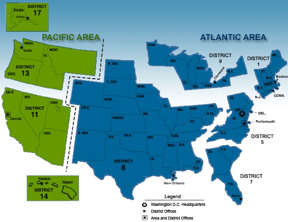
ENCs by Coast Guard Districts (map):
ENCs by State:
ENCs by Region (list):
* Zip File Date Time indicates when the zip file was created in Coordinated Universal Time. Resources: Click ENC Dates for more information about the Update Application Date and Issue Date. Click Coast Survey's Inquiry page if you have comments or suggestions. |
 The Nation's Chartmaker